Accès
Plan d'accès
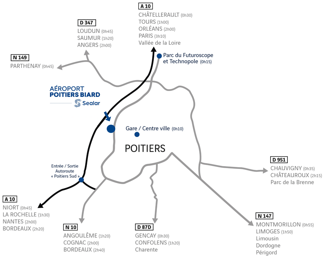
Situé sur la rocade ouest de Poitiers, à mi-chemin entre le Futuroscope et Poitiers Porte Sud, l’aéroport de Poitiers Biard se trouve à seulement 10 minutes du centre-ville et de la gare.
Un aéroport accessible pour un départ tranquille
L’aéroport de Poitiers Biard est très facilement accessible quelque soit le moyen de transport emprunté. Que vous veniez du centre-ville ou de villes proches, il sera très facile pour vous d’arriver à l’heure pour prendre votre avion.
Vous avez juste à suivre les panneaux routiers indiquant « Poitiers-Biard ». Si vous arrivez du nord de Poitiers, suivez la direction Angoulême, et si vous arrivez du sud, suivez la direction Châtellerault, Tours ou Futuroscope.
Nous vous conseillons toutefois de faire attention à la circulation parfois plus dense à certaines heures.

Coordonnées GPS
Aéroport de Poitiers-Biard 5 Rue du Sous-Lieutenant Collart, 86580 Biard, France
Latitude : 46.585936N | Longitude : 0.311347E
